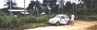
A large and spectacular cousin of the Buaya Sangkut Lata Seminyang This waterfall is in the Karak area. This is an area where orchard owners who spend a large part of their lives in the hills. Yes, they are so near to the falls yet they may not have been there. Jungles and forest- they don't take any fancy for what is within them. Their knowledge on falls is only hearsay, and you will be disappointed if you were to seek their assistance to learn more about the fall that you are searching. Coming back to Lata Seminyang, it is hidden in the Main Range, flowing down a pass between Bukit Kubang Ampung and Gunoung Hantu Besar. To reach the fall, proceed to Telemong Village in Karak District, just before reaching the destination, the road crosses a river named Perdak. Right after the bridge, there is a turning to the right. A laterite track that will take you to the fall. This track was made for the Mini Hydro Power station and its employees utilize the track to commute to work. You will be guided by the power cables to reach the Station. Although the track is maintained, it is only navigable by normal car up to 5 kilometers of the way. On this stretch, the track passes through rubber estates and durian plantations. Finally when all these are left behind, the track winds through primary forest.
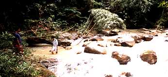
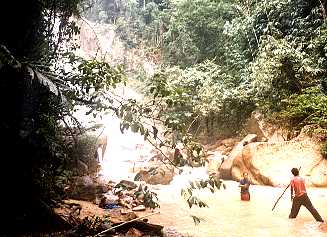
Then comes a second yard. After the 2nd yard, the road starts to go uphill. Broken by the rainwater, the track is only passable for 2 wheelers and 4X4 vehicles for the next kilometers until the Power Station. Within this spot, the sound of water rushing through the rocks is very significant as it is a stretch of rapids. In the past, the water and the area before the Power Station was so beautiful that it was a regular picnic area with pools close to 2 meter deep. The loggers had destroyed the landing area and the place was deserted. From the Station you still have another 3 kilometer of hike with 4 short climbs interspersed with level stretches. Continuing on the track, the next scene is that of the water catchments for the power station. A small path turns off to the right to reach into the ravine where the rapids are dammed. Choose the main track on your left and hike uphill. Very soon, at a point where the track is seen really leading uphill continuously, look for a trail on the right. This is a visible path on level ground heading right towards the direction of the river that cannot be seen or heard. If you study this place carefully, you are in a basin. The river is flowing normally and the terrain is flat. The 700-meter walk to the river is through damp forest and a path that is seldom used. At the end of which, the river comes into sight. At the time, a boulder blocks the path.
The spray in this area is very dense.
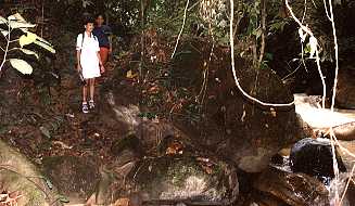
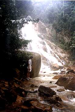
In the dry weather you could move around the rocks in the river bed to stay further away from the fall. If the water level is high, you are then confined to very small landing behind a boulder. Follow a path on your left and climb up the rocks to reach the middle stage. This is the part where the first long vertical drops lands. It is truly a magnificent sight!
The distance to the fall is 9 kilometers in from the main road, and it is in the Lentang Forest reserve. Do not plan your trip in the raining seasons. This is a highly dangerous area where the rising water can easily cuts your way out. |