|
|
| Waterfalls for the adventurous |
|
Lata Yuk
This
waterfall is in the vicinity of Lata Kinjang. In fact water for
the river comes from the same water basin at the top of the
ridge. The river at Lata Yuk flows southeastwards into another
valley while that of Lata Kinjang flows west.
The
recreation area at Lata Kinjang is fully developed and maintained
by the Forestry department. On weekends huge crowd fills the
picnic area judging from the looks of the overflowing car park.
To
reach Lata Yuk, choose the stream that flows out from your right
as you approach the Lata Kinjang Falls.
|
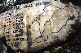
There are numerous circular tracks
as this crude sketch shows.
This is a trekking map for
"adventurer" who wish to go round the hills.
|
To
the officials, Lata Kinjang is the best looking Fall, when you
have seen this one, don’t waste time seeking other falls
within the region.
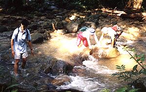
There
are two ways to reach Lata Yuk and in the last visit in March,
the upper route from the Sketch map location is blocked.
Then follow the lower path besides
the stream. This track requires only one river crossing.
If you are wearing shoes, make you choice at the crossing
whether you want to wet them.
The track will pass through
several campsites too.
|
|
|
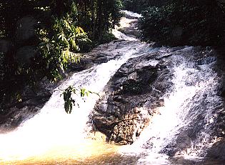
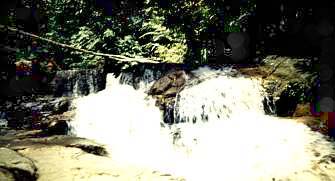
A 300 meters walk and there is Lata
Yuk. A long cascade with a drop of 30 meters
This "fall" as seen from
the base is among a series of 4 tall cascades.
The
remaining 3 others can only be seen when you are on
top.
|
To
reach the cascades on top follow the track on your left and move
up a steep slope. Very soon this track will meet up with another
one coming from Lata Kinjang,
As
mentioned earlier, the trail to the top cascades has been blocked
at this junction and by now over grown with weeds and bushes.
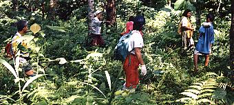
| Get a
guide from the "Orang Asli" village at the
picnic area to take you to the top. |
 |
Some
of the views are as follows.
 |
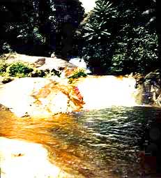
This is
the top fall, a vertical drop of 5 meters into a
beautiful pool. |
| The 2nd
fall is a 5 meters tall cascade that goes into a large
pool.
The pool looks extremely tempting, clear water,
deep and with a shallow mouth.
However, current at the
shallow outlet is strong and from there is a long slide
down.
|
 |
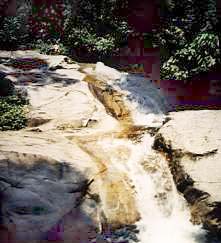 |
This is
followed immediately by 2 more long cascades totaling 30
meters tall before taking another turn to the top of the
final drop of 50 meters. If you see carefully, you can see
Khoo at the top of the cascades. He serves as a yardstick
to gauge the height of these 2 drops.
|
| 